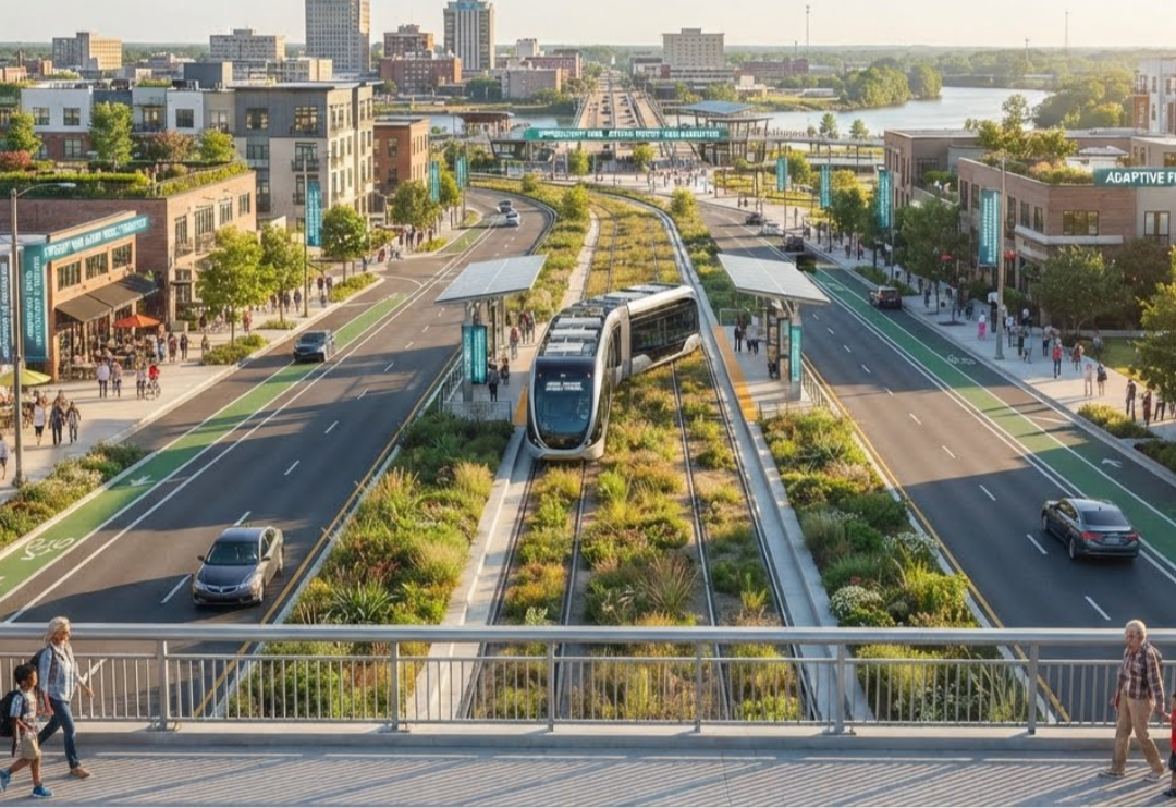

Shielding High-Value Economic Zones from Extreme Weather
Severe weather shouldn't paralyze regional commerce. Project Koridor's multi-layered defense architecture utilizes rapid-deployment logistics, smart transit lanes, and automated flood defenses to buffer critical industrial and transit infrastructure. By deploying real-time digital twins to simulate and manage hydro-mobility, we help cities and coastal business networks dramatically mitigate risk, protect multi-million dollar assets, and accelerate post-storm recovery timelines.
Integrated Decision Intelligence
Adaptive Decision Intelligence Framework
Implementing an end-to-end framework requires synchronized continuous feedback loops. By bridging raw observation with complex predictive models, systems can simulate real-world impacts before executing choices. This lifecycle ensures that data-driven organizations can seamlessly measure operational performance and actively adapt strategy to handle dynamic global market shifts safely and securely.
Strategies
We leverage a geospatial, digital-twin infrastructure powered by strategic AI scenario modeling. With over 25 years of specialized industry experience, our frameworks process layers of climate risk, land occupancy, demographic analytics, and water boundaries. This dense analytical visibility allows us to address complex macroeconomic engineering hurdles with absolute precision and clarity.
Plans
Every modern infrastructure solution demands a localized yet globally coordinated approach. Our tactical roadmap interconnects oceanic transport routes, smart urban nodes, and secure processing hubs into a unified logistics web. We dive deep into systemic data matrices to design resilient, future-proof blueprints custom-tailored to protect and scale your critical regional economic clusters.
HydroTwin OS: Automated Regional Fluid Dynamics
Hydro-Spatial Optimization Moats
We combine NVIDIA Modulus physics-AI engines with OpenAI cognitive workflows to deploy HydroTwin OS—an advanced predictive flood mitigation and automated drainage orchestration platform. By modeling complex local watershed topology as an interactive digital twin, the system simulates real-time fluid dynamics and runoff impacts under severe weather anomalies. HydroTwin OS automatically anticipates flash infrastructure stress, executing instant defensive rerouting protocols through Koridor OS and triggering automated edge-gate systems to isolate risks, safeguard mid-market supply chains, and preserve critical municipal assets.
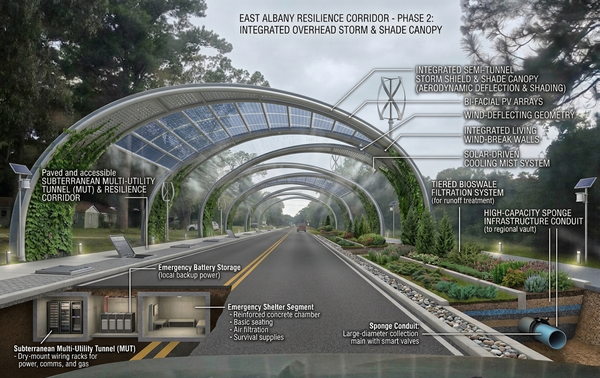
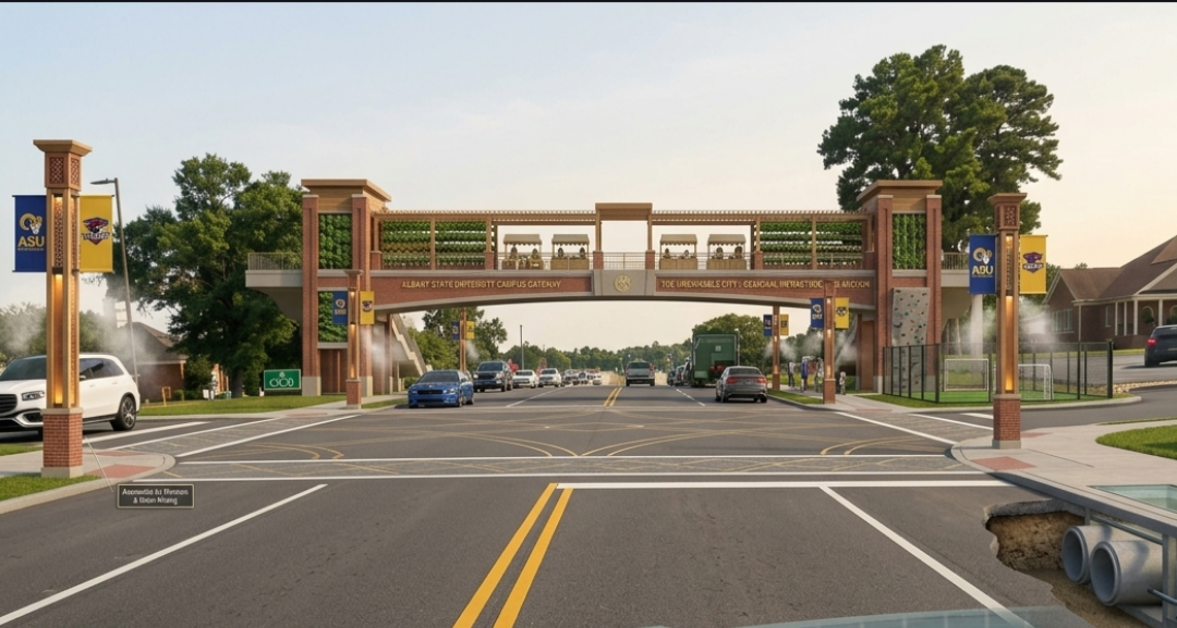
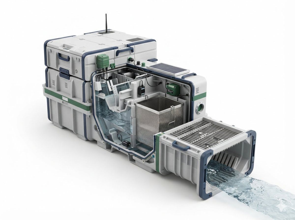
Our system maps complex regional vulnerabilities directly onto a responsive, interconnected physical framework. By layering automated telemetry, sovereign data structures, and advanced land defense systems like perfect-drain mounds and storm barriers, we actively intercept climate risks before they disrupt local life. From maritime ports to inland micro-economies, this multi-tiered architecture transforms passive infrastructure into an intelligent shield against regional flooding, protecting generational assets and building true economic resilience.
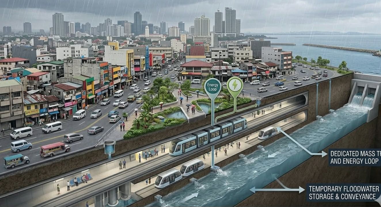
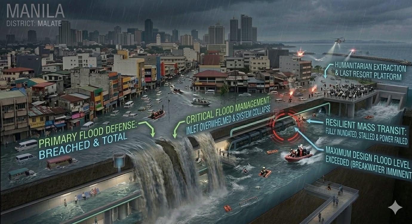
Project Koridor Philippines Flood Multi-Use Tunneling System



SEE THE SYSTEM
Spatial Intelligence & Digital Twins
© 2025 NVIDIA, the NVIDIA logo, and © 2026 Odynex Axis Logistics LLC, © 2026 SOWEGA Asian Pacific Chamber of Commerce & Foundation, and the © 2026 Odynex Institute are trademarks and/or registered trademarks of NVIDIA Corporation in the U.S. and other countries.